
Salt Lake City’s Grid System: Why It Helps Walking Tour Guests and Other Things to Do Near Salt Lake City
Aug 15, 2026
Salt Lake City’s grid is easy to understand once you know the directional numbering, but its long blocks and wide crossings can make a short-looking walk surprisingly demanding.
A map can make downtown Salt Lake City look like an easy stroll: straight lines, neat corners, and destinations only a few blocks apart. On the ground, those blocks are unusually long and the streets are broad, so we encourage visitors to think in feet and crossings rather than simply counting blocks.
Salt Lake City’s grid system is a coordinate-based street layout that helps walkers understand where they are in relation to the city center. It is useful for visitors planning a self-guided walk, considering a city-run walking tour, or deciding how much energy to save for one of the many things to do near Salt Lake City beyond downtown. We run day tours from Salt Lake City, so practical movement, realistic timing, and the difference between map distance and walking distance are central to how we plan every outing.
How does Salt Lake City’s grid system work?
Salt Lake City’s grid uses numbered streets and compass directions to show how far a location is from the city’s central reference point. Once visitors recognize that the number and direction describe a location’s position, the pattern becomes predictable rather than intimidating.
The basic reference point is at the intersection of Main Street and South Temple. Street addresses generally use a number followed by a direction, such as 300 West 600 North. In plain language, that address is west of Main Street and north of South Temple.
- North and south streets: Numbers increase as you travel away from South Temple in either direction. A street marked 600 North is north of the center; 600 South is south of it.
- East and west streets: Numbers increase as you move away from Main Street. An address on 300 West sits west of Main Street, while 300 East sits on the opposite side.
- Read the direction first: The directional word matters as much as the number. “300 West” and “300 East” are not interchangeable locations.
According to Salt Lake City, the city’s broad, spacious grid was designed to support navigation and walkability. For a visitor, the practical advantage is simple: the address itself gives a clue about which way to head, instead of functioning as a random street name to memorize.
A simple mental map for first-time walkers
Use Main Street as your east-west divider and South Temple as your north-south divider. If the first number in an address is getting larger while you walk west, you are moving farther west; if a north number is getting smaller, you are walking back toward the center.
Do not try to decode every coordinate while standing at an intersection. Check the next destination before leaving a stop, identify whether the larger move is north, south, east, or west, then use the grid only to confirm that you remain on course.
How far is a Salt Lake City block when you are walking?
A typical Salt Lake City block is approximately 660 feet on each side, so one block can take roughly two to three minutes at an ordinary walking pace before allowing for signals, photos, or stops. A route described as “a few blocks away” can therefore become a meaningful walk, especially when it includes several street crossings.
Six blocks in one direction are close to three-quarters of a mile. A route that goes three blocks west and three blocks north also adds up quickly because walkers cover both legs of the grid rather than traveling diagonally through buildings.
| Grid distance | Approximate distance | What it can feel like on foot |
|---|---|---|
| 1 block | About 660 feet | A short segment, though a wide crossing may slow it down. |
| 3 blocks | About 1,980 feet | A noticeable walk when repeated between sightseeing stops. |
| 6 blocks | About 3,960 feet | Close to three-quarters of a mile in one direction. |
The city’s streets are approximately 132 feet wide, which changes the rhythm of a walk. A crossing takes longer than visitors may expect, and waiting for signals can interrupt the pace. This is why a route with fewer turns is not automatically the easiest route if it requires repeated crossings of very wide streets.
You found a hidden promo code!
Use code WOWBLOG at checkout and get 10% OFF any tour!
Limited time offer. Book now and save!
Browse ToursWhy does the grid help walking tour guests?
The grid helps walking tour guests because it provides a clear mental framework for direction, meeting points, and route progress. Instead of guessing whether a street bends or changes name, walkers can usually expect right-angle intersections and logical numerical changes.
For guided groups, this structure makes it easier to explain where the group is heading and where it will regroup. A guide can say that the next stop is two blocks north and one block east, which gives guests a usable reference even if they are not watching a map.
- Orientation is faster: Directional street names reveal whether a destination lies north, south, east, or west of downtown.
- Turns are more predictable: Right-angle streets reduce the uncertainty common in irregular street patterns.
- Meeting points are easier to remember: A coordinate-style address gives a clearer location cue than an unfamiliar street name alone.
- Backtracking is easier to spot: If address numbers move in the wrong direction, walkers can correct course before adding more distance.
The grid is particularly useful when planning a focused downtown walk around a small number of stops. Visitors who want help deciding what makes a guided city walk worthwhile can use our broader guide on choosing a Salt Lake City walking tour without losing the first day to inefficient planning.
What makes Salt Lake City’s grid tiring or confusing for walkers?
Salt Lake City’s grid can feel tiring because long blocks, wide streets, and signal waits add physical and mental effort that is not obvious on a map. The numbering is logical, but newcomers may still need time to translate coordinates into a real walking direction.
The common misconception is that a numbered system eliminates the need for planning. It helps with orientation, yet it does not answer whether a route is comfortable in the available time, whether it requires multiple long crossings, or whether visitors are adjusting to the city’s elevation.
Three mistakes that make the grid harder than it needs to be
- Counting blocks without converting them to distance: Before setting out, treat every block as about 660 feet. Combine the north-south and east-west portions of your route rather than relying on a map’s straight-line appearance.
- Assuming every crossing is quick: Build extra time into a route that crosses several broad streets. Crossing delays can matter more than a single additional block on the same side of a street.
- Trying to see all of downtown in one outing: Choose a compact zone, then leave the rest for another walk. A comfortable pace makes it easier to notice architecture, signs, and neighborhood details.
Altitude can change how a reasonable route feels, particularly for travelers arriving from lower elevations. Our practical guidance on pacing a Salt Lake City walk while adjusting to altitude can help visitors decide when to shorten a route, pause, or switch to a less demanding plan.
How should a guide use the grid to make a walk more comfortable?
A good guide uses the grid as a route-planning tool, not merely as a navigation lesson. The strongest walking routes minimize unnecessary backtracking, reduce repeated wide crossings where practical, and set a pace that matches the real block lengths.
Guide support also removes the need for guests to continually calculate coordinates while trying to enjoy the surroundings. The value is not that visitors cannot navigate alone; it is that they can spend less attention on directions, timing, and regrouping.
We do not present ourselves as operators of dedicated downtown walking tours, and we do not claim to have measured every possible city route. For visitors walking independently, the practical standard remains clear: select a small area, group nearby stops on the same side of major streets where possible, and treat a multi-block detour as a real addition to the outing.
Those who want to add visual context to a compact downtown route can pair the grid with our guide to downtown Salt Lake City architecture for walkers. It helps turn a route into a more intentional walk rather than a race between addresses.
When should visitors walk downtown, and when should they choose a day tour from Salt Lake City?
Walk downtown when you want a flexible, close-up experience and can keep the route to a realistic number of long blocks. Choose a guided day trip when you want to reach Utah landscapes beyond the grid without calculating transport, distances, stop timing, or return logistics.
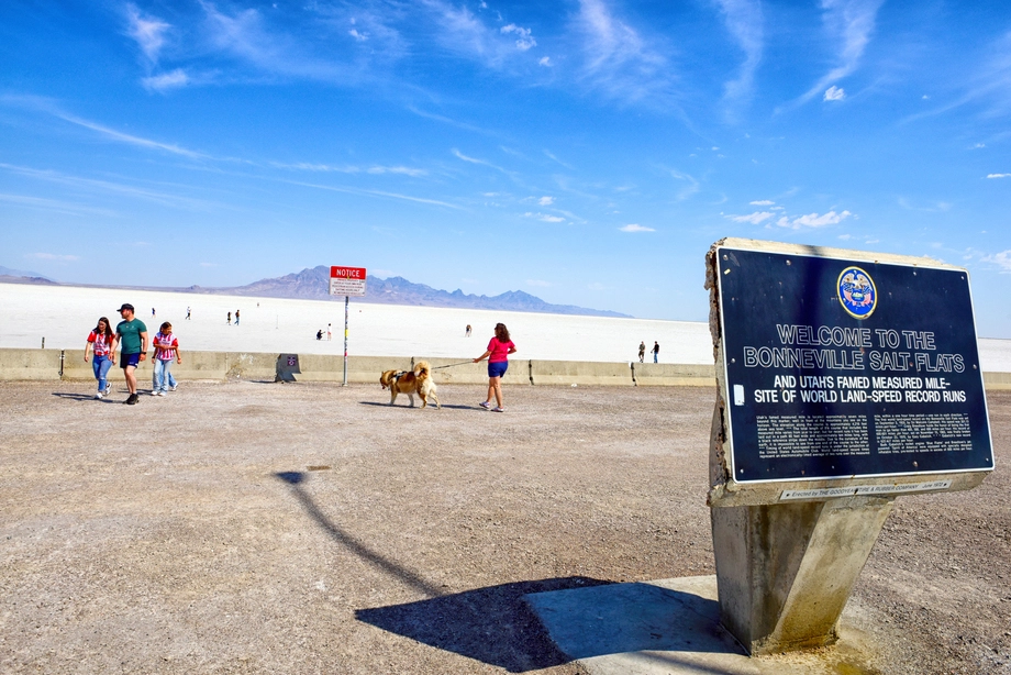
That choice is especially useful for a short stay. Downtown is well suited to a morning or afternoon of walking, while Antelope Island and the Bonneville Salt Flats offer a very different Utah experience that would be difficult to reach and time independently on the same schedule.
In our day-tour planning, we deliberately balance driving time with meaningful time at the destination. We organize transfers, build the route in advance, share guide commentary, and accompany guests on short walking sections so the day feels full without becoming rushed.
We also design these outings for travelers who prefer not to manage logistics alone, including families and groups of friends. Instead of asking guests to work out parking, route changes, and the distance between stops, we handle the movement between locations and keep the walking portions short and guided.
What our Salt Lake City departures include in practical terms
Our Utah Day Tours category is the practical next step after a self-guided downtown walk. It includes the Antelope Island Tour from Salt Lake City — From $120 | Matei Travel, the Antelope Island Sunset Wildlife Expedition – Great Salt Lake Odyssey, the Bonneville Salt Flats Tour from Salt Lake City — From $120 | Matei Travel, and the Bonneville Salt Flats Sunset Adventure of the White Desert — From $120 | Matei Travel.
On Antelope Island and Bonneville Salt Flats departures, transport and park entrance fees are included. We keep departures to a maximum of 13 guests, use a modern Mercedes Sprinter, and provide bottled water, hot drinks such as tea, coffee, and hot chocolate, plus granola bars on specific tours.
The Antelope Island Tour from Salt Lake City — From $120 | Matei Travel is approximately seven hours and has 8:30 a.m. and 2:30 p.m. departure times, with hotel pickup included. Its itinerary can include scenery, a souvenir stop, Fielding Garr Ranch, Bridger Bay Beach, Buffalo Point Trail, and information about the brine shrimp industry; wildlife sightings, including bison, cannot be guaranteed.
What is the best walking-plan checklist for the Salt Lake City grid?
The best grid-walking plan starts with one compact area, a realistic distance estimate, and a decision about how much time and energy to reserve for later activities. Visitors who make those choices before leaving their hotel are less likely to turn an enjoyable walk into an exhausting navigation exercise.
- Decode the address: Identify whether your destination is north, south, east, or west of the Main Street and South Temple reference point.
- Convert blocks into feet: Estimate about 660 feet per block before deciding that a destination is “close.”
- Count crossings: Note how often you must cross major streets, not only how many blocks you will walk.
- Choose a walking boundary: Pick a district or a limited cluster of stops rather than trying to cover distant corners of downtown in one outing.
- Protect your energy: Schedule a rest, meal, or hotel break before a longer activity later in the day.
- Plan the next experience: If you have limited time, compare departure times and inclusions for Antelope Island or the Bonneville Salt Flats before committing the rest of your stay.
What is the practical takeaway for visitors?
Salt Lake City’s numerical grid makes basic orientation easier, but it does not make every route short. Long 660-foot blocks and broad crossings reward visitors who plan a compact walk, allow more time than the map suggests, and avoid treating block counts as a measure of effort.
We use the same practical view of distance when we build our Utah day tours from Salt Lake City: movement should support the experience, not become the day’s main task. After exploring downtown on foot, compare our Utah Day Tours to check dates, departure times, and inclusions for Antelope Island or the Bonneville Salt Flats.
Where is the zero point for Salt Lake City addresses?
The central reference is the intersection of Main Street and South Temple. Address numbers generally increase as you move farther away from that point.
How long does it take to walk one Salt Lake City block?
A 660-foot block often takes about two to three minutes at a normal pace. Signals, wide intersections, and stops can add time.
Is 300 West 600 North difficult to understand?
It means the location is west of Main Street and north of South Temple. Read the directional words first, then use the numbers to judge relative distance from downtown.
Why do wide streets matter on a walking route?
Salt Lake City streets can be approximately 132 feet wide, so crossings require more walking and may involve a longer signal wait. Several such crossings can affect the pace of a short route.
Should I plan a full day of walking in downtown Salt Lake City?
Most visitors are better served by selecting a compact area and keeping the route flexible. The grid is straightforward, but its large blocks can make an ambitious itinerary feel longer than expected.
Are Matei Travel day tours strenuous hikes?
Our Salt Lake City departures emphasize scenic travel with short, guided walks on manageable sections. They are designed around a realistic balance of riding time and time outside the vehicle.
What is included on the Antelope Island Tour from Salt Lake City?
The tour includes transport, park entrance, hotel pickup, and a modern Mercedes Sprinter. Bottled water, hot drinks, and granola bars are also included on this tour.

Our guide was very knowledgeable, friendly and helpful. We saw lots of interesting parts of Utah...
Read more →Exceptionally knowledgeable guide who knew his facts and figures and history. He did everything to make...
Read more →We really enjoyed our trip!! Our guide was awesome and he took lots of pictures of...
Read more →Take this tour! My tourguide was TOP KNOTCH!- a lovely Ukrainian gentleman. He was able to...
Read more → Antelope Island – Wild Heart of the Great Salt Lake Adventure
 Antelope Island Sunset Wildlife Expedition – Great Salt Lake Odyssey
 Bonneville Salt Flats – Sunset Adventure of the White Desert
 Bonneville Salt Flats – Journey to the Edge of the World